ETRP Moodle Site ETRP Moodle Site
  • English ‎(en)‎
    English ‎(en)‎ Español - España ‎(es_es)‎ Español - Internacional ‎(es)‎ Français ‎(fr)‎ Русский ‎(ru)‎ العربية ‎(ar)‎ 简体中文 ‎(zh_cn)‎
  • You are currently using guest access (Log in)
  • FFGS-T
  • Home
  • Calendar

Training

  1. Home
  2. Courses
  3. FFGS-T

  • Acknowledgement - The training resources listed in this collection were developed by various individuals, projects and organizations.  Please make sure to attribute the authors appropriately when using these resources in the training you provide.

    ◄ ►


      • Readings


      • SAsiaFFGS MapServer User Guide

        South Asia Flash Flood Guidance System Forecaster Guide was developed by Hydrologic Research Center (HRC) to assist forecasts in operational use of the FFGS MapServer interface.


      • Videos


      • The videos listed below are tutorials developed by the Hydrologic Research Center (HRC) on the design of FFGS and its MapServer Interface. The list also includes tutorials on the operational use of FFGS products, the modelling components, the use of Numerical Weather Prediction Models in the FFGS, and the advanced capabilities for Urban Flash Flood Warning Systems.

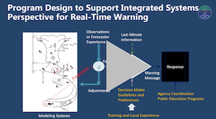
        Design of the FFGS – Part1

        Design of the FFGS – Part 2

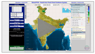
        FFGS MapServer Interface Overview

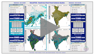
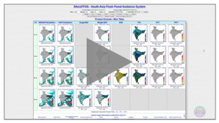
        Product Comparison Page - FFGS MapServer Interface

        Product Console Interface - Log Files

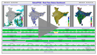
        Product Dashboard Interface - Overview

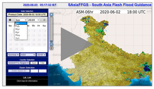
        Date Selection Tool - FFGS MapServer Interface
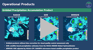
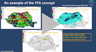
        FFGS Products

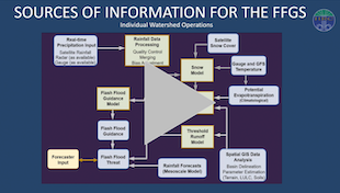
        Overview of FFGS Modeling Components – Part 1

        Overview of FFGS Modeling Components – Part 2

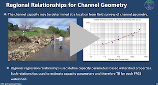
        Basin Delineation and Threshold Runoff

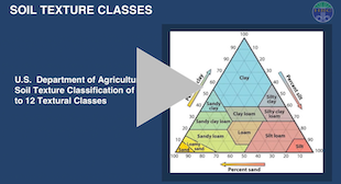
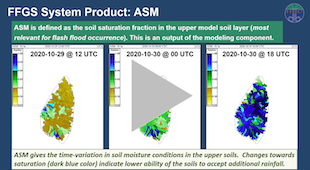
        Soil Moisture and Snow Models – Part 1

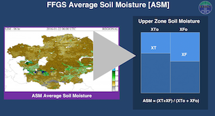
        Soil Moisture and Snow Models – Part 2

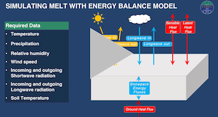
        Soil Moisture and Snow Models – Part 3

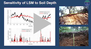
        Sensitivity of Land Surface Model

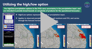
        Numerical Weather Prediction Model Use in FFGS

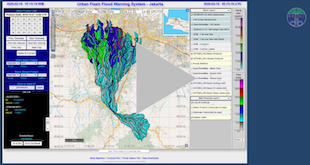
        FFGS Advanced Capabilities for Urban Flash Flood Warning System - Part 1. General Description and Basin Delineation

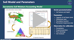
        FFGS Advanced Capabilities for Urban Flash Flood Warning System - Part 2. Precipitation, Soil Model and Parameters

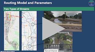
        FFGS Advanced Capabilities for Urban Flash Flood Warning System - Part 3. Routing Model and Parameterization

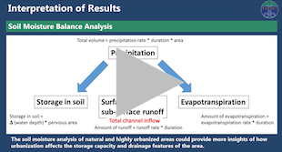
        FFGS Advanced Capabilities for Urban Flash Flood Warning System - Part 4. Interpretation of Results

    ◄ ►
    Skip FFGS Portal - Menu
    FFGS Portal - Menu

    FFGS Portal

    Communicating

    Training

    Forums

    About FFGS

    Skip Training - Menu
    Training - Menu

     HOME 

     1   Flash Flood Warnings and Preparedness

     2   FFGS Products

     3   FFGS Design & MapServer Interface

     4   FFGS Case Studies

     5   Hydrology

     6   Meteorology

     7   Remote Sensing

     8   Verification

     9   Flash Floods and Landslides

    10   Effects of Wildfires on Flash Flooding

    11   Geographic Information System (GIS)

    Skip Photo acknowledgement
    Photo acknowledgement

    Photos used in this Portal:
    Communicating: image by Rawpixel.com in Shutterstock.com; Training: image by Rawpixel.com in Shutterstock.com; Forums: image by Moomsabuy in Shutterstock.com; About FFGS: image by Vadven in Shutterstock.com; FFGS Portal: image by StevenDamron in Flickr.com.
    All images edited by Lu Veeck.

    Skip Copyright note
    Copyright note

    Every effort has been made to contact potential copyright owners. If any have been inadvertently overlooked, we will be pleased to make the necessary arrangements at the first opportunity.  If you have concerns, please contact us at ffgs@wmo.int 


    Skip Disclaimer
    Disclaimer

    The opinions expressed in this Portal are those of the authors and others who contributed to the development of the materials that are shared here. These do not necessarily reflect the views of the U.S. Agency for International Development, National Weather Service of the U.S., National Oceanic and Atmospheric Administration, Environment and Climate Change Canada, Hydrologic Research Center and World Meteorological Organization.

    You are currently using guest access (Log in)
    Home
    • English ‎(en)‎
      • English ‎(en)‎
      • Español - España ‎(es_es)‎
      • Español - Internacional ‎(es)‎
      • Français ‎(fr)‎
      • Русский ‎(ru)‎
      • العربية ‎(ar)‎
      • 简体中文 ‎(zh_cn)‎
    Data retention summary
    Get the mobile app